Business Details
Founded in 1992 by Bruce Hewlko, Sub-Arctic Geomatics has established itself as a leader in land surveying, mapping, and geomatics services across Canadas North. Our team of dedicated professionals has prepared approximately 33% of the Plans of Survey registered in the Northwest Territories and Nunavut, demonstrating our deep expertise and commitment to the region. In 2018, we merged with Challenger Geomatics, another well-established northern firm, to enhance our capabilities and better serve clients across the Canadian North. Together, we maintain a permanent presence in numerous northern communities, employing local members whenever possible to foster sustainable development. Our extensive experience includes involvement in every diamond mine project in the Northwest Territories and Nunavut, from exploration to reclamation.
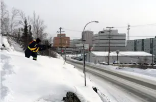
We specialize in residential, commercial, mining, construction, and government surveys, ensuring accuracy and efficiency in even the most challenging conditions. Our partnerships with First Nations communities reflect our commitment to collaboration and mutual success. With offices spanning all three territories, we deliver tailored solutions backed by decades of local knowledge and a rigorous quality management process. Whether supporting public infrastructure, private developments, or resource extraction, we prioritize reliability, safety, and community impact. Our teams ability to operate in extreme climatesfrom -40F to +86Fensures that we meet client needs cost-effectively and precisely. At Sub-Arctic Geomatics, we combine technical excellence with a deep understanding of northern logistics to provide unparalleled service.
We specialize in residential, commercial, mining, construction, and government surveys, ensuring accuracy and efficiency in even the most challenging conditions. Our partnerships with First Nations communities reflect our commitment to collaboration and mutual success. With offices spanning all three territories, we deliver tailored solutions backed by decades of local knowledge and a rigorous quality management process. Whether supporting public infrastructure, private developments, or resource extraction, we prioritize reliability, safety, and community impact. Our teams ability to operate in extreme climatesfrom -40F to +86Fensures that we meet client needs cost-effectively and precisely. At Sub-Arctic Geomatics, we combine technical excellence with a deep understanding of northern logistics to provide unparalleled service.
Services
Residential Surveys
Commercial Surveys
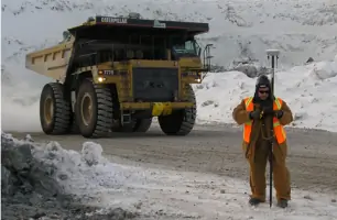
Mining Surveys
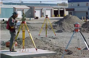
Construction Surveys
Engineering Surveys
Government Surveys
Legal Surveys
Topographic Surveys
As-Built Surveys
Aerial Mapping
Highlights and features
- We have over 30 years of experience in northern surveying.
- Our team includes certified experts with deep local knowledge.
- We maintain partnerships with First Nations communities.
- We operate efficiently in extreme northern conditions.
- We provide tailored solutions for residential, commercial, and mining projects.
Services
Residential and Commercial Surveys
We specialize in legal surveys for residential and commercial properties, including subdivision, boundary staking, and real property reports. Our services support landowners, property managers, and developers with precise, reliable data. Whether for new developments or existing properties, we ensure compliance and accuracy.
Mining Surveys
Our team provides comprehensive surveying for mining projects, from exploration to reclamation. We support surface and underground operations with advanced tools and methodologies. Clients benefit from our experience with every diamond mine in the Northwest Territories and Nunavut.
Construction and Engineering Surveys
We offer topographic, as-built, and construction layout surveys for foundations, roads, and buildings. Our local knowledge and territorial coverage ensure efficient project execution. Trust us for accurate data to guide architectural and engineering decisions.
Surveys for Local, Territorial and Federal Governments
We provide legal and boundary surveys for government clients, including right-of-way and public land disposition mapping. Our work supports infrastructure projects and land claim agreements. Clients rely on our precision and adherence to regulatory standards.
Aerial Mapping
Our aerial mapping and remote sensing services deliver unique insights for mining and large-scale projects. We use advanced technology to capture accurate, high-resolution data. This supports exploration, monitoring, and reclamation efforts efficiently.
Videos