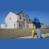
Business Details
Your Trusted Partner for Professional Land Surveying in Ontario
At Rodney Geyer Ontario Land Suveyor, we have established ourselves as a premier destination for professional land surveying solutions, combining technical excellence with client-centric service. Our team delivers precise boundary delineation, topographic mapping, and construction staking using cutting-edge technology to ensure accuracy in every project. With a focus on legal compliance, site analysis, and innovative drone-based aerial surveying, we serve homeowners, developers, and contractors across Ontario.Our commitment to precision extends to grading design and engineering surveys that support infrastructure development. By maintaining integrity, transparency, and a client-first approach, we consistently exceed expectations while adhering to the highest professional standards. Our collaborative methodology ensures clients receive expert guidance throughout their project lifecycle.
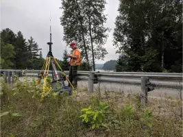
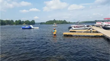

Services
Legal Boundary Surveys
Topographic Mapping
Construction Staking
Drone Aerial Surveys
Grading Design
Highlights and features
- We utilize advanced drone technology and modern surveying equipment for superior accuracy.
- Our team provides legally compliant boundary determinations with meticulous attention to detail.
- We offer comprehensive site analysis for construction and infrastructure development projects.
- Our client-first approach ensures personalized service from project initiation to completion.
- We maintain transparency and ethical standards in all surveying operations and documentation.
Services
Legal Boundary Surveys
Our legal boundary surveys precisely define property lines using advanced technology to ensure regulatory compliance. This service helps homeowners and developers avoid disputes while providing accurate documentation for land transactions. Our surveyors combine field measurements with title research to deliver reliable boundary determinations.
Topographic Mapping
We create detailed topographic maps showing natural and man-made features with elevation data. This service supports construction planning and environmental assessments by providing accurate terrain representations. Our team uses modern equipment to capture precise measurements for engineering applications.
Construction Staking
Our construction staking services ensure accurate project implementation by marking physical locations based on design plans. This critical service guides builders in positioning structures correctly while maintaining dimensional integrity throughout the development process.
Drone Aerial Surveys
We employ drone technology for efficient aerial surveys that capture comprehensive site data. This service provides rapid, cost-effective mapping solutions for large areas while maintaining high accuracy standards for land development projects.
Grading Design
Our grading design services create effective land shaping plans that optimize water drainage and site usability. This service integrates with construction projects to ensure proper site preparation and long-term functionality of developed properties.
Questions
What surveying services do you offer?
We provide legal boundary surveys, topographic mapping, construction staking, drone aerial surveys, and grading design services for residential and commercial clients.
How do you ensure survey accuracy?
We use modern surveying equipment and drone technology combined with professional expertise to maintain high accuracy standards in all our projects.
Do you serve residential clients?
Yes, we assist homeowners with property boundary determination, land development, and construction-related surveying needs across Ontario.
What makes your services unique?
Our combination of technical expertise, modern technology, and client-focused approach ensures precise results tailored to each project's specific requirements.
Reviews (2)
Jim Lowe
Apr 21, 2021
Report
Positive:Professionalism,Responsiveness
Knowledgeable, professional, and (uncommon when it comes to land surveyors) - incredibly responsive. When you ask for a quote, they get it to you quickly - not whenever they decide to get around to it. Definitely recommended.
Knowledgeable, professional, and (uncommon when it comes to land surveyors) - incredibly responsive. When you ask for a quote, they get it to you quickly - not whenever they decide to get around to it. Definitely recommended.
Bill Shoup All Round Health & Fitness
Nov 13, 2019
Report
Looking for a land surveyor, call Rodney he will set the land site true so that there are no question of where your land start and finishes.