Business Details
50+ Years
experience
Trusted Land Surveying Services in Winnipeg
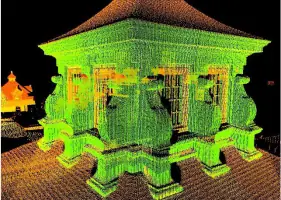
Stevens Surveys is a highly reputable land surveying firm established in 1970, dedicated to delivering precise and reliable cadastral surveying services across Manitoba, Nunavut, and the Northwest Territories. Our team combines decades of expertise with advanced technologies like high-definition laser scanning to address both urban and remote project challenges. We maintain direct professional control over all work stages, ensuring adherence to rigorous quality standards and ethical practices.With certifications from the Association of Manitoba Land Surveyors and Association of Canada Land Surveyors, we serve public and private sectors, specializing in boundary resolution, subdivision projects, and geomatics solutions. Our commitment to innovation, client collaboration, and logistical preparedness in harsh environments has solidified our reputation as Manitobas premier surveying firm.
Services
Cadastral Surveying
Subdivision Surveys
Geomatics Services
Construction Surveying
Remote Area Projects
Details
- Year established: 1970
Highlights and features
- MLS & CLS Certified for legal surveying expertise
- 40+ years of experience since 1970
- Personalized service with direct client communication
- Proven success in remote and harsh environments
- Investment in cutting-edge surveying technologies
Associations and certifications
- Association of Manitoba Land Surveyors
- Association of Canada Land Surveyors
Services
Cadastral Surveying
Cadastral surveying establishes legal boundaries for land, water, and air space through precise measurements and title research. Our team uses advanced GPS and robotic total stations to ensure compliance with statutory standards. Clients benefit from accurate boundary staking, subdivision maps, and dispute resolution services backed by over 50 years of combined expertise.
Subdivision Surveys
Subdivision surveys convert large parcels into smaller lots through meticulous planning and fieldwork. We prepare Subdivision Application Maps (S.A.M.) and coordinate with local authorities to ensure regulatory compliance. Our process includes boundary verification, monument placement, and final plan registration, supporting residential, commercial, and government projects across remote and urban environments.
Geomatics Services
Geomatics services integrate topographic mapping, GPS networks, and digital terrain modeling to support infrastructure development. We provide construction control, deformation monitoring, and photogrammetric ground control using state-of-the-art equipment. Clients receive detailed data for site planning, grading certification, and architectural integration, ensuring project accuracy from design to execution.
Remote Area Projects
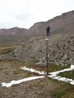
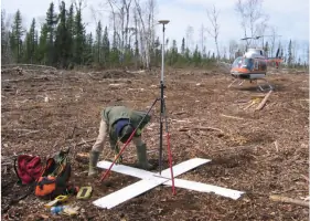
Remote area projects involve surveying in extreme environments like Nunavut and Northwest Territories. Our team conducts bathymetric surveys, treaty land entitlement mapping, and North Warning System installations using GPS and helicopter logistics. Clients gain reliable data for jurisdictional transfers, dredging verification, and First Nations land allocations, even in locations requiring multi-day travel.
Construction Surveying
Construction surveying ensures accurate layout of buildings, roads, and utilities through stake-out and elevation control. We support projects like the Portage La Prairie Recreation Multiplex with grid line establishment and pile location staking. Clients receive precise measurements for foundation certification, lot grading, and final as-built documentation, ensuring alignment with design specifications.
People
Doug Stevens
Owner
Doug Stevens, a Manitoba and Canada Land Surveyor since 1990 and 1994 respectively, leads Stevens Surveys with over 25 years of field experience. He holds a B.Sc. in Survey Engineering from the University of Calgary and a private pilots license to support remote operations.
Questions
What services does Stevens Surveys offer?
We specialize in cadastral surveying, subdivision projects, geomatics, construction support, and remote area surveys for government and private clients.
Which regions do you serve?
We operate across Manitoba, Nunavut, and the Northwest Territories, with expertise in both urban and remote environments.
How long has Stevens Surveys been in business?
Since 1970, we’ve provided surveying services, combining decades of experience with modern technology for accurate results.
Are your surveyors certified?
Yes, we hold certifications from the Association of Manitoba Land Surveyors and Association of Canada Land Surveyors.
Can you handle complex remote projects?
Yes, we’ve completed surveys in extreme locations like Pangnirtung Fiord and Nunavut’s mining claims using specialized logistics.
Reviews (2)
Jamie Bernard
Aug 21, 2020
Report
Positive:Professionalism,Responsiveness
Doug was friendly, helpful, and provided useful knowledge and information about next steps.
Doug was friendly, helpful, and provided useful knowledge and information about next steps.
Nancy Prokop
Sep 16, 2019
Report
We had the most positive experience with Stevens Surveys and would not hesitate to recommend them. The field staff was friendly, polite and very professional. The job was completely quickly and efficiently. The office staff were excellent in explaining the process and we're always there to answer any questions we had. We have already recommended them to family and friends.