Business Details
Your Trusted Partner for Surveying, Engineering & Reality Capture Solutions
Servant Dunbrack McKenzie & Macdonald is a trusted provider of surveying, engineering, and reality capture solutions, dedicated to transforming development ideas into reality. With over 60 years of combined experience in surveying innovation and a decade of expertise in reality capture, we deliver precise data and sustainable design solutions for land development, construction, and heritage preservation. Our team leverages cutting-edge technology, including 3D laser scanning and BIM integration, to reduce project risks, enhance accuracy, and streamline workflows.We prioritize client collaboration, offering tailored services that align with project goals while adhering to industry standards. Our commitment to accountability, technical excellence, and client satisfaction has solidified our reputation as a leader in Atlantic Canada.
Services
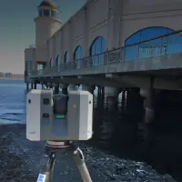
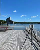
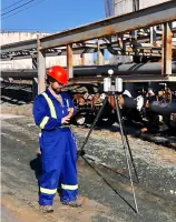
3D Laser Scanning
As-Built Surveys
Land Surveying
Civil Engineering
Subdivision Design
Building Permit Approvals
Virtual Tour Walkthroughs
3D Modeling
Site Design Services
Reality Capture
Highlights and features
- We combine 60+ years of surveying innovation with state-of-the-art 3D laser scanning technology.
- Our team delivers tailored solutions for complex projects in construction, engineering, and heritage preservation.
- We provide accurate as-built documentation and digital twin models to reduce project risks.
- Our services integrate seamlessly with BIM and CAD workflows for enhanced efficiency.
- We prioritize client collaboration and accountability, ensuring deliverables meet project-specific needs.
What people say
Absolute pleasure
Informed approach
High level of service
Accurate data
Expertise
Services
3D Laser Scanning
Our 3D laser scanning service captures detailed measurements of construction sites and buildings, enabling accurate as-built documentation and clash detection. This technology enhances project efficiency by providing precise data for design and renovation. Clients use our scans for BIM integration, heritage preservation, and industrial site assessments.
As-Built Surveys
We create detailed as-built surveys using laser scanning to document existing conditions for renovations or compliance. These surveys reduce errors during construction by ensuring designs align with real-world data. Our deliverables include CAD drawings and Revit models for seamless project coordination.
Land Surveying
Servant Dunbrack McKenzie & Macdonald provides land surveying services for property development, boundary determination, and topographic mapping. Our surveys support infrastructure projects and legal compliance, ensuring accurate site analysis. We use advanced tools to deliver reliable data for municipal and private clients.
Civil Engineering
Our civil engineering team designs site infrastructure, including stormwater systems, grading plans, and subdivision layouts. We focus on sustainable solutions that meet regulatory standards while optimizing land value. Services extend to municipal approvals and construction management for residential and commercial projects.
Reality Capture
Reality capture generates virtual replicas of physical sites using 3D scanning and photogrammetry. These models support remote collaboration, facility management, and design validation. Clients benefit from reduced site visits, improved accuracy, and enhanced decision-making throughout the project lifecycle.
Questions
What is reality capture and how does it benefit construction projects?
Reality capture uses 3D scanning to create digital twins of physical sites, improving accuracy, reducing rework, and enabling better collaboration for construction and renovation projects.
What industries do SDMM's services support?
We serve construction, engineering, architecture, heritage conservation, and municipal sectors with tailored surveying, engineering, and 3D modeling solutions.
How does SDMM ensure the accuracy of its surveys?
We use state-of-the-art laser scanning technology, experienced professionals, and rigorous quality checks to deliver precise data aligned with project requirements.
Can SDMM assist with municipal approvals for land development?
Yes, we navigate municipal processes, prepare subdivision plans, and secure permits to ensure compliance with local regulations and standards.
What deliverables do you provide for 3D scanning projects?
We offer point clouds, Revit models, CAD drawings, and virtual walkthroughs for design, analysis, and documentation purposes.
Do you offer services outside Halifax?
Yes, we serve clients across Eastern Canada, including Nova Scotia, New Brunswick, and Prince Edward Island.
Reviews (1)
David Roddis
Dec 04, 2020
Report
I had SDMM come to confirm my property boundaries before putting an outbuilding in. The price was extremely fair, and the guys on site were awesome and actually did a few extra things since they were on site. I would strongly recommend them if you are looking for expert help on your property.