Business Details
37 Years
experience
Precision Construction Surveying & Geomatics Services
Founded in 1989, we have built a reputation as a trusted leader in geomatics and construction surveying. Our team combines decades of industry experience with cutting-edge technology to deliver precision, safety, and cost efficiency across heavy civil, industrial, and commercial projects. We specialize in advanced surveying techniques, including drone aerial mapping, machine control optimization, and 3D modeling, ensuring projects are completed on time, within budget, and to the highest standards. Our COR certification by the British Columbia Construction Safety Alliance underscores our commitment to safety and operational excellence.With a focus on innovation and client collaboration, we empower productive job sites through tailored solutions that reduce rework, enhance productivity, and minimize environmental impact. Our expertise spans infrastructure development, mining, and industrial construction, serving clients in British Columbia, Canada, and internationally. Backed by a team of certified professionals, we prioritize transparency, technical excellence, and long-term partnerships, ensuring every project reflects our core values of integrity, precision, and client-centric service.
Services
Heavy Civil Surveying
SmartSite Solution
Engineering Surveying
Machine Control Optimization
Drone Aerial Mapping
Drafting & 3D Modeling
Site Audit
GPS Programming
Operator Training
Digital Terrain Modeling
Details
- Year established: 1989
Highlights and features
- We offer over 30 years of experience in geomatics and construction surveying.
- Our team utilizes advanced technologies like drone mapping and machine control.
- We prioritize safety with BCCSA COR certification and rigorous protocols.
- Our solutions reduce rework by up to 20%, saving clients millions.
- We provide nationwide and international project support with local expertise.
Associations and certifications
- BCCSA COR Certified
Services
Heavy Civil Surveying
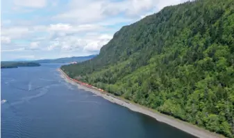
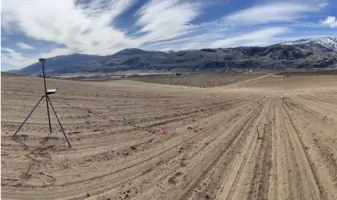
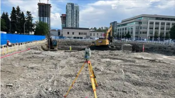
Our heavy civil surveying services support large-scale infrastructure projects like roads, bridges, and railways. Using GPS and laser scanners, we ensure precise alignment and compliance with regulatory standards. Clients benefit from reduced rework, enhanced safety, and timely project delivery through our expertise in earthmoving and excavation guidance.
SmartSite Solution
SmartSite is a comprehensive solution that integrates geomatics, drafting, and 3D modeling to minimize rework and boost productivity. By automating data preparation and onsite problem-solving, we help clients save up to $24M on $400M projects while ensuring seamless execution and cost efficiency.
Drone Aerial Mapping
Partnering with SWIFT, we use drones equipped with LiDAR and thermal imaging to create orthomosaic maps and 3D models. This technology enables rapid data collection over large areas, improves safety by surveying hazardous zones remotely, and provides clients with detailed insights for accurate planning and execution.
Machine Control Optimization
Our machine control services automate construction equipment like excavators and graders using GPS and digital site plans. This reduces fuel consumption, equipment wear, and labor hours by up to 46%, enhancing precision, safety, and environmental sustainability while lowering project costs.
Drafting & 3D Modeling
We create detailed 3D models and accurate engineering drawings to identify design errors before construction begins. Using advanced software, we prevent costly mid-project changes, ensuring optimal design efficiency and reducing unplanned work caused by inaccurate documentation.
People
Jeff Ennis
Co-Owner/CEO
Jeff Ennis co-founded OSDC and pioneered systems to enhance construction site productivity. With expertise in heavy civil projects, he brings over two decades of experience in surveying and operational innovation to the company's leadership.
Kristen Livingston
Office Manager
Kristen Livingston oversees OSDC's administrative operations with over a decade of experience in construction industry management. Her organizational skills ensure efficient office processes and client communication.
Eric Miller
Crew Supervisor
Eric Miller leads field teams with a decade of civil engineering experience. His technical expertise and project management skills ensure seamless execution of complex surveying tasks.
Adhit Nugraha
Survey Technician
Adhit Nugraha combines geomatics engineering expertise with a passion for mentoring. His technical skills in surveying and commitment to innovation support OSDC's precision-driven projects.
Samantha King
Survey Technician
Samantha King specializes in underground surveying with a decade of field experience. Her attention to detail and dedication to accuracy contribute to OSDC's high-quality deliverables.
Questions
What services does Okanagan Surveying Design Company offer?
We provide geomatics and construction surveying services, including drone aerial mapping, machine control optimization, 3D modeling, engineering surveying, and SmartSite solutions for heavy civil, industrial, and commercial projects.
What industries do you specialize in?
We specialize in heavy civil infrastructure (roads, bridges, railways), industrial construction (factories, power plants), and mining projects, leveraging advanced technology for precision and efficiency.
How does your technology improve project outcomes?
Our machine control and drone mapping technologies reduce rework by up to 20%, enhance safety, and cut costs by automating processes and minimizing human error.
Are you certified for safety standards?
Yes, we hold BCCSA COR certification, demonstrating our commitment to rigorous safety protocols and risk management across all projects.
What areas do you serve?
We operate throughout British Columbia, Canada, and internationally, including projects in the Cayman Islands and Prince George.
Reviews (4)
Ian Gall
Jan 27, 2022
Report
Positive:Responsiveness,Value
Jeff is super responsive and has helped a lot with our vineyard development project.
Jeff is super responsive and has helped a lot with our vineyard development project.
Shawn
Jan 15, 2022
Report
I have worked with Okanagan Survey and Design Ltd. for a number of years, planning, surveying and staking out roads, quite often through dense brush in steep and sometimes rugged terrain. Working with Okanagan Survey and Jeff Ennis always adds to my knowledge in how to work expeditiously and professionally in situations that often require quick and accurate decisions. I consider working with Jeff Ennis and his team a truly good experience.
Bruce Clarke
Jul 05, 2020
Report
Positive:Professionalism,Quality,Responsiveness,Value
I've had the pleasure to work with Jeff and his team over the past two years on our Monashee Ridge project. They are the best site survey team we've worked with in the Okanagan, highly recommend them.
I've had the pleasure to work with Jeff and his team over the past two years on our Monashee Ridge project. They are the best site survey team we've worked with in the Okanagan, highly recommend them.
Jadyn Lowe
Jan 14, 2020
Report
We've had the pleasure working with Jeff and his staff at Okanagan Survey and design over many projects in the Okanagan area. Jeff has always had great communication, great standard of quality of work and punctual. Jeff has been a key to our success in the Okanagan and would highly recommend Jeff and OSD any time.
Emry Formworks
Emry Formworks