Business Details
Professional Land Surveying Services in British Columbia
Summit Land Surveying is a professional land surveying firm serving British Columbia with offices in Victoria and West Kelowna. Our team of certified professionals brings decades of combined experience in residential, commercial, and legal surveying projects. We specialize in cadastral, topographic, construction, and environmental surveys using advanced technologies like robotic total stations and drones.Our commitment to ethical standards and technical excellence ensures accurate, reliable results for private landowners, developers, and government agencies. With deep local knowledge and modern equipment, we deliver efficient solutions tailored to each project's unique requirements.


Services
Residential Surveys
Cadastral Surveys
Topographic Surveys
Construction Surveys
Environmental Surveys
Geodetic Surveys
Highlights and features
- We have over 25 years of local surveying experience in British Columbia
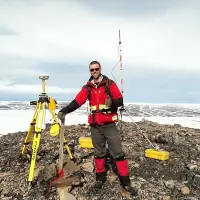
- Our team uses advanced surveying technologies including drones and GNSS
- We maintain strict ethical standards and client confidentiality
- Our surveyors hold formal certifications from recognized institutions
- We serve both private and public sector clients across multiple industries
Associations and certifications
- Association of British Columbia Land Surveyors
Services
Residential Surveys
Residential surveys help property owners understand their land boundaries and prepare for construction. We create site plans for building permits, mark property lines for fence installations, and provide building location certificates. Our surveys ensure compliance with local zoning regulations and help prevent boundary disputes.
Cadastral Surveys
Cadastral surveys establish legal property boundaries for land transactions. We create subdivision plans, strata developments, and rights-of-way documentation. Our legal survey plans get registered with the Land Title and Survey Authority of British Columbia to create official property records.
Topographic Surveys
Topographic surveys map natural and man-made features of a property. We document elevations, buildings, utilities, and vegetation to create detailed site plans. These surveys support construction projects, environmental assessments, and land development planning across British Columbia.
Construction Surveys
Construction surveys ensure accurate project implementation. We provide excavation layout, foundation staking, and building location verification services. Our work helps contractors maintain proper grading and meet building code requirements throughout the construction process.
Environmental Surveys
Environmental surveys support ecological assessments and conservation efforts. We provide precise location data for riparian areas and monitoring wells. Our work helps environmental professionals track changes and implement protection measures for sensitive natural areas.
People
Jason C. Kozina
BC Land Surveyor
With 25+ years experience, Jason oversees Victoria operations. Holds BCIT degree and ABCLS certification. Specializes in Vancouver Island projects for private and government clients.
Jacob Wall
BC Land Surveyor
Graduated with Geomatics honors in 2007. Combines field experience with software expertise. Completed articles under Jason Kozina and obtained BCLS commission in 2019.
James H. Thomas
BC Land Surveyor
12+ years in land surveying across Canada. Completed UNB geomatics program. Obtained BCLS commission in 2021 after diverse experience in energy and infrastructure projects.
Questions
When is a land survey needed?
Residential surveys are recommended before property purchases or construction. Cadastral surveys establish legal boundaries. Topographic surveys support development projects.
Can I move property survey markers?
Only licensed BC Land Surveyors can set or replace official survey monuments. Moving markers without authorization can create legal boundary issues.
Are land surveys legal documents?
Yes, survey plans are legal documents prepared by licensed professionals. Registered surveys become official records with the Land Title and Survey Authority.
Do survey records become public documents?
Surveys registered with land title offices become public records. Municipal submissions may also become public, but some surveys remain private client records.
What technology do you use?
We use robotic total stations, multi-frequency GNSS, digital levels, and drones. This equipment ensures accurate data collection for various surveying applications.