Business Details
9 Years
experience
Professional Land Surveying Services in Windsor, ON
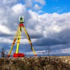
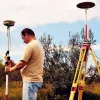
Founded in 2017, Surveyors On Site has established itself as a leader in delivering cost-effective, timely surveying solutions across North America. Our commitment to leveraging cutting-edge technologyincluding robotic total stations, 3D laser scanners, and underground service locatorsensures unparalleled precision and efficiency. With eight full-time field crews, we handle projects of all sizes, from small residential surveys to large-scale infrastructure developments. Our team of licensed professionals, including Ontario Land Surveyors, brings decades of combined experience in cadastral, engineering, and industrial surveying.We prioritize client satisfaction through transparent communication, adherence to strict deadlines, and competitive pricing. Our mission, 'On Time, On Site, On Budget,' reflects our dedication to exceeding expectations while maintaining the highest standards of accuracy and reliability. Operating across Ontario and Michigan, we serve diverse industries, including construction, mining, and municipal planning.

Services
Topographic Surveys
Cadastral Surveys
High Rise Construction
3D Laser Scanning
Underground Surveying
Deformation Monitoring
Control Surveys
Volume Surveys
Severances
Metrology
Details
- Year established: 2017
Highlights and features
- We use state-of-the-art surveying technology for precise results.
- Our team includes licensed professionals with extensive industry experience.
- We deliver projects on time and on budget, ensuring client satisfaction.
- We operate across North America, handling projects of all sizes.
- Our eight full-time field crews provide efficient, scalable solutions.
Services
Topographic Surveys
Topographic surveys create detailed 3D frameworks for engineering and design projects. By mapping terrain features accurately, we enable informed planning and workflow efficiency. Clients rely on our data for infrastructure, environmental, and construction projects across North America.
Cadastral Surveys
Cadastral surveys establish legal property boundaries for transactions and development. Our licensed Ontario Land Surveyors deliver precise documentation to ensure compliance with municipal and legal standards. This service is critical for real estate transactions and land development.
3D Laser Scanning
Using LIDAR technology, we capture detailed 3D data for digital modeling. This enables accurate design, analysis, and record-keeping for complex structures and landscapes. Clients benefit from enhanced visualization and data-driven decision-making for their projects.
Underground Surveying
Our gyroscopic technology allows precise underground surveys for mines and tunnels. By eliminating the need for traditional reference points, we ensure fast, accurate data collection in challenging environments. This service supports safe and efficient infrastructure development.
Deformation Monitoring
Deformation monitoring tracks structural movements to ensure public safety. Using advanced tools, we detect minute shifts in buildings, bridges, and infrastructure. Clients depend on our data to maintain structural integrity and prevent potential hazards.
People
Christopher Oyler
President
Christopher Oyler, a licensed Ontario Land Surveyor, brings extensive engineering and cadastral expertise to SOS. With a background in environmental technology and over a decade of surveying experience, he leads our team in delivering precise, client-focused solutions across North America.
Questions
What services does SurveyorSOS offer?
We provide topographic, cadastral, construction, 3D laser scanning, underground, and deformation surveys, along with specialized services for mining, infrastructure, and municipal projects.
How can I request a quote?
Contact us via phone at 519-818-0767 or visit our website to submit an inquiry form for a customized project estimate.
Do you work outside Ontario?
Yes, we operate across North America, including Michigan, with field crews equipped to handle projects in diverse locations.
What technology do you use?
We employ robotic total stations, 3D laser scanners, GPS networks, and gyroscopic tools to ensure precision and efficiency in all surveying tasks.
How do you ensure project accuracy?
Our licensed professionals use calibrated equipment and follow rigorous quality control protocols to deliver reliable, repeatable results for every project.
Videos
Reviews (1)
Anna Pischti
Mar 31, 2021
Report
Easy and a pleasure to deal with Surveyors On Site Inc. / thanks Ryan and a big thanks to Todd 😁