Business Details
Professional Land Surveying Services in Brampton
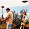
Kad Lanka Surveying is a professional land surveying company operating under the authorization of the Association of Ontario Land Surveyors. We specialize in providing comprehensive cadastral, topographic, and construction survey services to clients across the Greater Toronto Area. Our team leverages extensive industry knowledge and cutting-edge technology to deliver accurate, timely, and cost-effective solutions tailored to meet client-specific requirements. Founded by Vineetha Rathnayake, a licensed Ontario Land Surveyor with over 30 years of experience, our firm combines decades of expertise with ethical professional standards to ensure legal compliance and technical precision.We serve diverse clients including engineering firms, real estate agents, land developers, and private landowners, prioritizing client satisfaction through transparent communication and adherence to Ontario's surveying regulations. Our commitment to excellence is reinforced by mandatory professional liability insurance and our role as expert witnesses in boundary dispute resolution.
Services
Boundary Surveys
Topographic Surveys
Construction Surveys
Reference Plans
Land Severance
Surveyors Real Property Reports
Precision Monitoring
Subdivision Plans
Highlights and features
- We employ licensed Ontario Land Surveyors with 30+ years of combined industry experience
- Our team uses advanced surveying technology for superior measurement accuracy
- All surveys comply with Ontario legal requirements and professional standards
- We provide expert court testimony in boundary dispute resolution cases
- Mandatory professional liability insurance protects our clients' interests
Associations and certifications
- Association of Ontario Land Surveyors
Services
Boundary Surveys
Our boundary surveys precisely determine property limits to prevent legal disputes. Using Ontario Land Surveyor standards, we examine documentary evidence and physical markers to establish accurate boundary lines. This essential service protects property investments during purchases, construction projects, or fence installations.
Topographic Surveys
We create detailed topographic maps showing natural and manmade features with elevation data. These surveys support engineering designs and development plans by providing accurate terrain models for drainage analysis, construction planning, and land management applications across Ontario.
Construction Surveys
Our construction survey services ensure precise building placement and grading. We provide layout for foundations, utilities, and infrastructure projects using advanced equipment to maintain dimensional accuracy throughout the construction process for developers and contractors in the GTA.
Reference Plans
We prepare official reference plans for land registry deposits. These documents show surveyed boundaries, easements, and physical features affecting property titles. Required for land severances, our plans meet Ontario Land Surveyor standards for legal land division and registration.
Surveyors Real Property Reports
Our SRPRs illustrate building locations relative to property boundaries with detailed issue analysis. These reports help buyers, sellers, and lenders identify boundary conflicts and title concerns before property transactions, meeting Ontario's legal requirements for real estate transfers.
People
Vineetha Rathnayake
President
Licensed Ontario Land Surveyor with 30+ years of experience. Former government surveyor in Sri Lanka, now leading Kad Lanka Surveying since 2011 while serving as Survey Manager at Strabag Inc.
Kamal Kadirage
Operations Manager
Experienced surveyor with 30+ years in land and tunnel surveying. Registered professional surveyor in Sri Lanka, bringing extensive technical expertise to Ontario construction and land development projects.
Questions
Why hire a licensed Ontario Land Surveyor?
Only licensed professionals can legally perform surveys in Ontario. They ensure legal compliance, maintain professional standards, and provide court-admissible documentation for property transactions.
What services do you offer?
We provide boundary surveys, topographic mapping, construction layout, reference plans, land severance documentation, and Surveyors Real Property Reports for residential, commercial, and industrial clients.
How do surveys protect property investments?
Accurate surveys prevent boundary disputes, ensure proper land use, and identify title issues before property purchases, saving potential legal and financial complications.
Do you serve both public and private sectors?
Yes, we work with engineering firms, real estate agents, land developers, construction companies, and private landowners across the Greater Toronto Area.
What technology do you use?
We employ modern surveying equipment including total stations, GPS systems, and digital data collectors to ensure measurement accuracy and efficient data processing.